rareoldprints.com


Search

If you know the reference number
enter it here:


If you enter more than one word
it will be treated as phrase.

Insert "and" or "or" between words to search for the words in any order.

Refine your search here or build another search.
Displaying 0 to 10 of 12 - Next -
91%
A New Map of the County of Monmouth
Ref: P/471
Region: Monmouthshire
Type: Copper
Cartographer: Smith C
Publisher: C.Smith
Date: 1804

90%
Wiltshire
Ref: P/3292
Region: Wiltshire
Type: Copper
Engraver: Gardner
Publisher: C.Smith
Date: 1828

Not for sale
87%
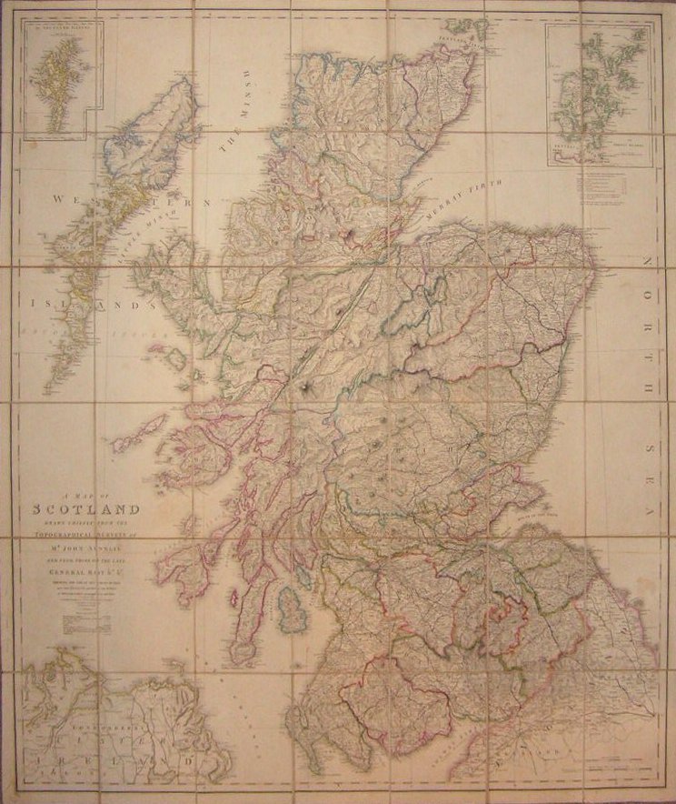
A Map of Scotland Drawn Chiefly from the Topographical Surveys of Mr John Ainslie and from those of the late General Roy &c &c Shewing the Great and Cross Roads, and the Distances between the Towns, by William Faden, Geographer to the King.
Ref: P/5036
Region: Scotland
Type: Copper
Cartographer: Ainslie J
Publisher: Js Wyld

85%
Dept. des Landes.
Ref: P/13636
Region: Landes
Type: Steel
Cartographer: Levasseur V
Engraver: Smith C

84%
Plan of Plymouth, Devonport, Stonehouse &c.
Ref: P/6888
Region: Plymouth
Type: Chromo-lithograph
Publisher: G.W.Bacon
Date: 1885

Sold
84%
Dept. de Gers
Ref: P/13627
Region: Gers
Type: Steel
Cartographer: Levasseur V
Engraver: George E et Smith C

84%
Dept. de la Vendee.
Ref: P/13662
Region: Vendee
Type: Steel
Cartographer: Levasseur V
Engraver: Smith C

83%
Bacon's Plan of Plymouth, Devonport Stonehouse, &c.
Ref: P/18471
Region: Plymouth
Type: Chromo-lithograph
Publisher: G. W. Bacon & Co

Sold
83%(no image available)
Wiltshire
Ref: P/8108
Region: Wiltshire
Type: Lithograph
Date: 1896

Not for sale
82%
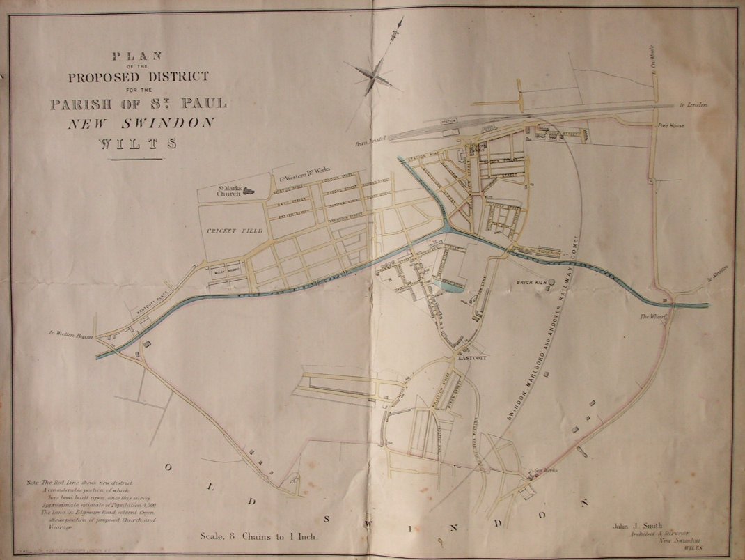
Plan of the Proposed District of the Parish of St. Paul, New Swindon Wilts
Ref: P/3574
Region: Swindon
Type: Lithograph
Cartographer: Smith J.J.
Engraver: Kell G.F.

Not for sale

Displaying 0 to 10 of 12